DEVON AND
CORNWALL
August–September,
2013
BACKGROUND
Over 30 years ago, we toured England, Scotland,
Wales, along with two weeks in Ireland with our 16-year-old daughter.
We spent a month working our way across England, Wales, and Scotland.
While we had no preconceived itinerary or plan, we touched on many of
the highlights of this small island— Canterbury, Stonehenge,
Tintagel, Hay-on-Wye, Welsh castles, Loch Ness, Aberdeenshire (home of
the early Moirs) York, and London. We ferried to Ireland for a two-week
visit to what has become, in our memories, the home of beautiful
landscapes and some of the friendliest people on earth (along with the
Kiwis). As we did in Britain, we traveled by car, stayed in some
wonderful B&Bs, and made our way without a plan across the country
to wind up in Dublin for an international conference, which was the
purpose (or excuse) for the trip. It was the first of seven (or eight)
“Great Trips” we have been fortunate to experience.
We recently learned of an opportunity (or excuse?)
to return to England when a timeshare opened up for a week in rural
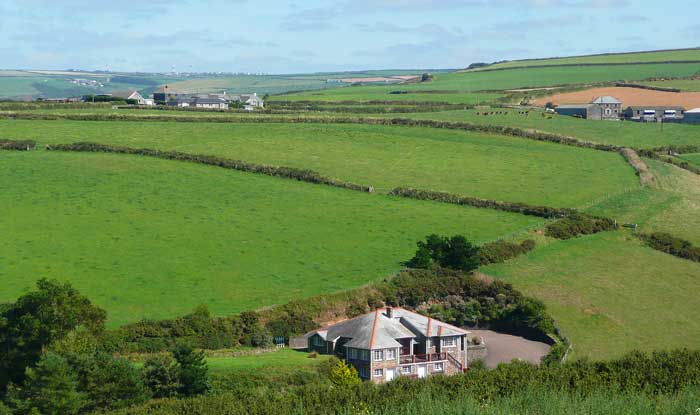
Devon: Woodford
Bridge Country Club (photo on left). This is a part of the UK we
barely touched upon during our 1982 visit.
This centrally located facility is less than a day’s drive from the
southern coast of Cornwall (Penzance, Land’s End, St. Ives, etc.) and
the northern coast of Devon (Clovelly, Ilfracomb, Lynmouth, et al.),
and within easy reach of the historic city of Exeter and the moors of
Dartmoor National Park and Exmoor National Park.
We also went as fans of the British program “Doc
Martin,” a British TV production available to us on PBS, DVD, and
streaming Netflix. We have watched it since the first episodes came to
our attention and fell in love with the star of the show: the tiny
fishing village of Port
Isaac on the northern coast of Cornwall. Could
this tiny village (population 700) really be as attractive in reality
as it is dressed up for a TV show? We had to see for ourselves.
We flew into Heathrow on Air Canada through Montreal
and located the Green Motion car rental agency which had our Yaris
waiting for us. It turned out that this small agency is not at Heathrow
at all but at one of four area Holiday Inns several miles away. None of
the other rental agencies at the airport had heard of them and didn’t
know where they were located. The confirmation we had received before
leaving did not include their address or phone number. It took advice
from friendly local at the airport to get to the pickup point via two
buses and a lot of walking. With our fingers crossed and a ratty atlas
of the country, we found an entrance to the M4 and headed west toward
Bristol and on to our first stop: the East Dyke Farmhouse
B&B in
Clovelly.
CLOVELLY
This small village of about 400 residents is a
major tourist destination due to its picture postcard beauty nestled
comfortably in a small cove on Barnstable Bay on Devon’s north coast.
The village has been privately owned by one family or another since the
1200s; today the village is operated by the Clovelly Estate Company
which charges an adult entrance fee of £6.50 (± $10.25).
We intended to have dinner at the Red
Lion Hotel—a popular harbor side
location for dinner—and therefore had the fee waived. We saved $20.50,
but didn’t have dinner at the Red Lion Hotel, though we had intended
to.
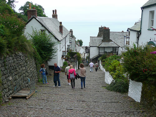
The road from the car park to the bottom of the
village is quite steep and paved entirely with cobblestones, making the
400-foot descent—and ascent—quite a serious challenge and at times
treacherous, especially when the
stones are damp. Donkeys still pull wooden sledges up and down to
transport personal goods and provisions for the few retail shops. (They
used to carry people in the past). Two inns, two museums, a cafe and
pub serve the needs and interests of visitors.
We visited Clovelly when we toured England in 1982
and loved it; nostalgia prompted us to make this our first stop this
trip. Little appears to have changed in 30 years despite a devastating
flood just last October that created a river of mud that shot down
the
main street, lifting cobbles and destroying everything in its path.
Today there are few reminders of that devastation.
We decided to forego the Red Lion Hotel for dinner
since they began serving later than we wanted (and their menu was
limited). Instead, we drove west to the small town of Hartland for
dinner at the Hart Inn (one
of several suggestions by our B&B
hosts). The Hart Inn is a very friendly, warm local pub with a most
interesting menu and finest food of the trip prepared by a chef with
training and experience quite unexpected in a such a remote area.
Judy’s grilled hake dinner with fresh local vegetables was superb, and
Hughes’s pork tenderloin with mash and black pudding was
outstanding—the dining highlights of our trip. The presentation would
have done a five-star restaurant proud. In short we were flabbergasted
and quite delighted that we had stumbled blindly upon this gastronomic
gem in such humble surroundings. If you are ever traveling in this
area, arrive early for seating and bring your appetite.
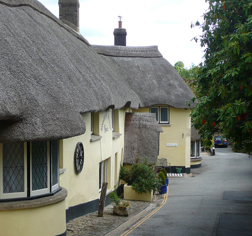
Our accommodations at the East Dyke Farmhouse were
very comfortable and clean. We chose this particular B&B because of
its location (a short walk/drive to entrance to Clovelly), the Trip
Advisor rating (best in the area), and the remarkable breakfast menu
they posted on their web site. We were not disappointed. Helen Goaman
is a cheerful, helpful hostess and a fine cook. We joined two other
English couples who were staying there and heard of their travel
suggestions while enjoying a fine start to the day. Both couples
remarked about how fortunate we were to be traveling during the
warmest, driest summer in recent memory. The usual fog and drizzle of
southwest England had given way to blue skies and warm temperatures for
most of the ten days we were there.
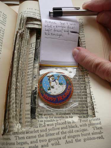
GEOCACHING
AND BIDEFORD
In the morning, as we left the B&B, we drove
back to Clovelly’s All Saints Church at the top of the village where we
had located, online, a geocache in which we intended to place a travel
bug from an Arizona geocacher in England during our trip. This seemed a
lovely spot with easy access. We searched and searched for the one
supposedly placed near the church, but after nearly 45 minutes, we
concluded it had been “muggled” (moved or taken) before we got there.
However, we had a stroke of good fortune later that day when we stopped
in Bideford on our way to our main destination, Woodford Bridge Country
Club in rural Milton Demerel Holsworthy.
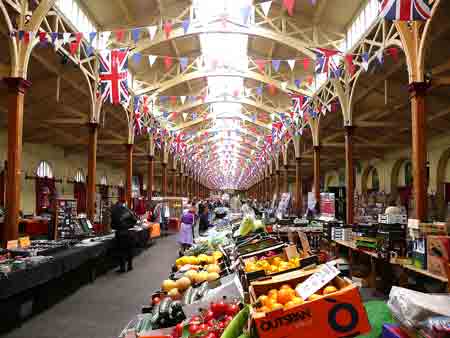
We drove through the growing city of Bideford
(pop.
17,000), a port on the River Torridge and stopped to shop at the
Pannier Market, an indoor produce and crafts market in an area of this
lively town with galleries, bakeries, butchers, and small specialty
shops. As we were driving into downtown, we noticed several crowds of
people along the waterfront and on the side streets wearing red shirts.
It turned out that not only was there a rowing regatta in progress but
there was a geocache
flash mob: geocachers from around the area showed
up at a particular time to do mass geocaching. Fortunately for us, we
met a young couple in the Pannier
Market with red shirts, learned they
were geocachers, and when we told them of our promise to relocate the
travel bug, they eagerly volunteered to “grab” it and place it
somewhere in the area, thereby fulfilling our obligation to hide the
travel bug.
We stayed in Bideford to watch some of the regatta,
which was exciting for the folks who came from around the area to see
the competition. We later enjoyed fresh strawberries and clotted cream
at a farmer’s market in the park, bought a generous supply of groceries
at the local Morrison’s, and then headed south to Woodford Bridge, a
half hour south.
We checked in easily enough, found our two-bedroom
cottage, checked that everything worked and was in place, put our
groceries and clothes away, and walked around the facility and up to
the bar for some pre-dinner real ale and a glass of wine. Dinner in the
dining room was comfortable and quiet, but lacked the warmth and the
camaraderie of local pubs which we sought out throughout our trip. We
took this time to think about how we wanted to spend our time in the
coming week. We knew we wanted to bike the popular Tarka Trail; explore
the moors of Dartmoor National Park, and several coastal fishing
villages both in Devon and Cornwall. We looked for special events,
shopping opportunities, and local pubs.
BIKING THE
TARKA TRAIL
This well known 180-mile
path for runners, hikers
and cyclists loops through north and central Devon and includes a
30-mile section from Greater Torrington to Barnstable on train bed of
the former Tarka Line Railway. Its rolling terrain, wide profile, and
scenery make this section ideal for bicyclists. It is also possible to
continue seven miles north of Barnstable to Braunton; cyclists can also
chose the eleven-mile “southern” route from Greater Torrington to
Petrockstowe and Meeth. The most popular section of the trail parallels
the River Torridge from Great Torrington to Barnstable, a flat and
scenic 15-mile stretch that passes through Bideford and Instow where
there are refreshments easily available.
[The
original “Tarka” was an otter featured in a popular children’s story
Tarka the Otter by local writer Henry Williamson written in 1927 and
set in this section of north Devon. The book remains respected today
for its realism and careful accuracy of life along the River Taw and
River Torridge. It was made into a film in 1979.]
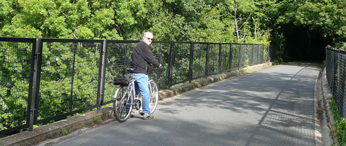
We rented bicycles from the Torrington Cycle Hire
and rode leisurely for about four hours following this well used and
clearly marked path through dense deciduous forests, through old train
tunnels, across bridges that crossed the River Torridge and estuaries
at Bideford Bay. We passed hundreds of people during the morning:
couples, families, and individuals biking, walking, and running
(including participants in a 10-mile race from Bideford to
Barnstable). We stopped in Barnstable for a quick fix on Hughes’s seat,
and on the return at John’s
Delicatessen in Instow for a snack of tasty home
cooked pasties (PAST-tease) and strong coffee. We got back to Woodford
Bridge for a well earned rest, showers, and light dinner in the room
followed by some entertaining British TV.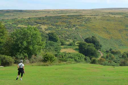
TREKKING
THE MOORS OF DARTMOOR
There are those who have enthusiasm for the bleak
and often wild landscapes found in Yorkshire, southwest England, and in
other places in Europe and around the world (the largest moorland area
is in Columbia!). We are not among this group. The moors of Dartmoor
National Park consist mainly of grasses, sedges, peat, and bracken
that cover a
predominately granite base rock. Few trees exist in this desolate area
that draws visitors who are no doubt fans of Romantic English
literature
including Wuthering Heights, The Secret Garden, The Hounds of the Baskervilles and
the like. Rocky tors and stone monoliths are can be found here and give
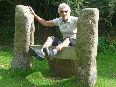
cause to speculation about Arthurian and Druid activities. We came
because we felt we should experience this area and attempt to breathe
in the spirit of the moors about which others have written so
enthusiastically.
 The drive to the northern edge of Dartmoor National
Park took longer than it looked like it should have on the map. But
roads in that part of England are rarely more than two narrow
lanes—though paved—never straight
for more than a half mile, and often
poorly signed. What traffic there is usually included at least one farm
tractor blocking a good portion of the road. Our route from Woodford
Bridge to Holsworthy to Hatherleigh to Okehampton is probably not much
more than 30 miles, but slow. It was even slower finding the small
village of Belstone on
the edge of Dartmoor. Finding a path that led
into the moor took another few minutes, but find it we did: we really
only had to look across to the hillside that rose across the grassy
knoll across from town through which a small creek flowed. Like the
most of Devon and
Cornwall, there are many public footpaths, but almost no signs to guide
the visitor.
The drive to the northern edge of Dartmoor National
Park took longer than it looked like it should have on the map. But
roads in that part of England are rarely more than two narrow
lanes—though paved—never straight
for more than a half mile, and often
poorly signed. What traffic there is usually included at least one farm
tractor blocking a good portion of the road. Our route from Woodford
Bridge to Holsworthy to Hatherleigh to Okehampton is probably not much
more than 30 miles, but slow. It was even slower finding the small
village of Belstone on
the edge of Dartmoor. Finding a path that led
into the moor took another few minutes, but find it we did: we really
only had to look across to the hillside that rose across the grassy
knoll across from town through which a small creek flowed. Like the
most of Devon and
Cornwall, there are many public footpaths, but almost no signs to guide
the visitor.
Our hiking on the nearby moor was brief and
uninteresting. Nothing we encountered captured our imagination except
the view of the surrounding countryside, particularly the tiny village,
its church and well preserved houses and public buildings, and the
green expanse next to the free house/inn, The Tors, where we decided to
have lunch.
[A
pub
or public
house
and a free house
are generally considered different terms for the same thing: a place
that serves drinks to the public. In some cases, however, a pub is tied
to a particular brewery that determines which brands of beer or ale can
be served, whereas a free house is independently operated by the owner.]
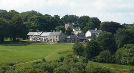
After lunch we walked through this quiet village,
taking particular notice of the 13th century church, the telegraph
office that was once the Zion Chapel, the stocks used for public
humiliation and punishment, wandering sheep throughout the village
area, and the “Belstone
pound” a small fenced enclosure “originally
used to impound stray animals until claimed by their owners.” We
appreciated the quiet and rural quality of this small (population about
250) and ancient village (mentioned in the Doomsday Book, 1086 C.E.).
FISHING VILLAGES OF DEVON AND CORNWALL
Though we enjoy biking and hiking, we
acknowledge that we most looked forward to urban hiking on this trip.
We enjoy finding a quiet (or sometimes busy) town or village with
plenty of retail opportunities, especially if there are secondhand or
thrift shops, and we found plenty. We also discovered “boot sales”
(our version of flea markets), pannier markets, and local outdoor
produce markets. We also tried hard to contribute, through purchases,
to a wide variety of charitable organizations, from orphans and people
with terrible diseases to hospice and homeless animals. Most towns of
any size have donated merchandise for resale and we spent a good time
shopping these stores: Judy for gifts and clothes, and Hughes for good
books and a CD by a Somerset group from the 1970s called The Werzels
(he didn’t find any CDs, but you can see and hear them on YouTube.com).
We focused our time on fishing villages and
beachside towns. We covered the west coast from Ilfracombe on the
northwest Devon coast on Bristol Channel to St. Michael’s Mount on
Mount’s Bay on the south coast of Cornwall. Each town and village was
distinctive, wonderfully scenic, and a postcard in the making.
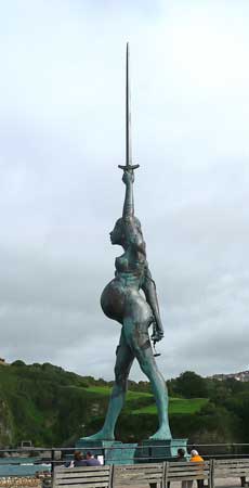
Ilfracombe. This seaside resort
city of
about 10,000 inhabitants is a concentration of tall apartment buildings
that face the harbor, the lighthouse (oldest in the UK) on
Lantern
Hill, and “Verity,”
a 67-foot bronze and steel statue by Damien Hirst
of a very pregnant woman holding a sword aloft. The view from the top
of Lantern Hill affords an excellent view of the main section of town
and the controversial award-winning Landmark
Theater,
nicknamed “Madonna’s Bra” because of the double conical design. With so
much to see from Lantern Hill and the walk around it, we spent no time
at all wandering the streets of this popular vacation destination. We
did notice that many of the folks out and about were our age or older.
Croyde. One of the longest and
widest beaches on a
sheltered bay in north Devon lies a half-mile walk
from the small, compact village of Croyde, which lies just a few miles
south of Ilfracombe. If the vacationers in Ilfracombe are generally
part of the senior, sedentary set, Cryode appeals to younger, more
active visitors, especially surfers looking for decent waves and
campers who want a seaside vacation. New surfing equipment and clothing
stores sit next to older, traditional thatch roof homes and buildings
from the times when agriculture flourished. There are several
restaurants/pubs from which to choose, and ice cream cones sold on
every corner. We had a tasty lunch in the sitting out area of Billy
Budd’s Pub on this warm and sunny day. We walked to the beach to
watch
the surfers trying to make something of the low surf. How would they
would love Hawai’i!
Appledore and Westward Ho! From
even the most cursory glance along the streets of Appledore
it is clear
the village was founded on fishing. Located on the estuary of the River
Torridge, Appledore was settled by the Celts, then the Saxons, was
raided by the Vikings, and resettled during the Elizabethan period as a
port, a shipbuilding and shipping center, as well as supported a
continuing fishing industry. A maritime museum describes the history of
this small village (pop. 2100), and the town has, since 1825, supported
a lifeboat station for ocean search and rescue operations. Tourism does
not seem to have flourished yet in this blue collar,
working class town.
Just next door is the vacation resort town of Westward Ho!
The name was
inspired by Charles Kingsley’s novel of the same title, and was built
in the 19th century for the sole purpose of providing a healthy and
beautiful seaside vacation destination, and to promote tourism in this
part of Devon. Along with casinos, Westward Ho! offers visitors arcades
and a go-kart track to children, plenty of fast food and ice cream
shops, and the loudest music on any part of the Devon
coastline. The Royal
North Devon Golf Club claims to be the oldest golf
course in England. The beach at Westward Ho! is three miles of clean
sand backed by a pebble ridge and grasslands. Clearly this town of 2100
was and is a vibrant, “happening” spot for family vacations without
historical, geographical, or architectural features to divert attention
from eating,
playing, and having fun.
[Westward
Ho! and Saint-Louis-du-Ha!
Ha! in Quebec are probably the only cities
in the world that have at least one exclamation mark in their names.
Just thought you might want to know.]
 Bude. South of Westward Ho! (and
skipping Clovelly which was discussed earlier) is the quiet town of
Bude (rhymes with cued or
feud). It began as a Victorian seaside resort
town which continues to attract surfers, and is an important source of
sand that is rich in calcium carbonate, a natural fertilizer, that was
transported inland to enrich the fields of farmers in that part of
Cornwall. A small canal was constructed in the 17th century to protect
the town from Atlantic storms. On our visit, we were impressed with the
slower pace and quiet surroundings of what remains a pleasant, low-key
tourist destination.
Bude. South of Westward Ho! (and
skipping Clovelly which was discussed earlier) is the quiet town of
Bude (rhymes with cued or
feud). It began as a Victorian seaside resort
town which continues to attract surfers, and is an important source of
sand that is rich in calcium carbonate, a natural fertilizer, that was
transported inland to enrich the fields of farmers in that part of
Cornwall. A small canal was constructed in the 17th century to protect
the town from Atlantic storms. On our visit, we were impressed with the
slower pace and quiet surroundings of what remains a pleasant, low-key
tourist destination.
Bude is also the home of Sir
Goldsworthy Gurney who
invented what has become known as a Bude
Light, a device that creates
an intense white light by injecting oxygen into the center of an Argand
burner (a home lighting oil lamp). Bude Lights were used in coastal
lighthouses and, for over 50 years in the 19th century, lit the House
of Commons until electricity was installed. A cone shaped statue that
commemorates Gurney’s invention stands in a circular plaza at the foot
of Bude Castle.
Along the promenade in front of the canal is the
Bude Public Library, an attractive stone building that is nicely
organized, cozy, and seems about the right size for a town of 9,000. We
went in because of our interest in libraries and because it housed an
unusual geocache that we had located on line. Hidden in a cut out
section of a thick book on bats we easily found GC4FM69 “The Mammoth
Book of...@Bude Library” and left another trackable we had brought from
home.
[Note:
The English, especially in Devon where the
activity began (in Dartmoor in 1854), have a pastime similar to
geocaching called “Letterboxing.”
Like geocaching, it involves outdoor
navigation and hunting for a hidden “treasure.” Unlike geocaching, no
technological device is required, but cards are hidden in a letterbox
and clues are provided in magazines, web sites, word of mouth, etc. The
letterboxes contain a log (to note who found it and when) and a rubber
stamp for the finder’s notebook to record the find. The popularity of
letterboxing has begun to spread to this country and seems to be
gaining in popularity here.]
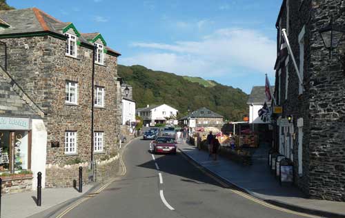
Bocastle.
Fourteen miles south of Bude is a small (pop. 900), out of the way
village where the River Valency runs through the heart of the town and
empties into the Atlantic Ocean. Originally strictly a fishing port
(and we like to think a likely haunt of smugglers) Bocastle is a
destination for those visitors who dare to navigate the narrow twisting
road that leads from the A39 to the harbor. There they will find a
National Trust Shop and the Witchcraft
Museum which has had a
controversial and colorful history. The beauty of Bocastle is that
there is little to detract the visitor from the beauty of the place:
there are a half dozen excellent retail shops, a grocery, several pubs
and cafes, and a lovely walk from the center of town to the end of the
harbor.
One can easily see how a steep and narrow river
valley might be susceptible to flooding. In fact, in the summer
of
2004, a huge flood roared through the village, trapping residents
in
their houses, on the roofs of cars, or simply drove them to seek higher
ground up the road out of town. The Visitors Center was washed out to
sea, as were 50 cars, and the bridge across the river. The town roads
suffered under nine feet of water and mud. The sewage system burst and
Bocastle was declare inaccessible. Helicopters were required to provide
rescue, the largest peacetime rescue operation in UK history. Several
buildings now note the flood water level as a reminder of that terrible
tragedy. (Bocastle flooded again three years later, but the damage was
much less. Even so, one can easily see how vulnerable this small area
is to
the ravages of water.)
Tintagel. Just a few miles south on
the coast from Bocastle is the fabled town of Tintagel,
legendary home
of Arthur, Merlin, and the knights of the round table. It is one of the
most visited places in Britain. We were among the tiny minority of
visitors that day who did not pay a call to this attractive and
historic village. We had visited 30 years before and decided that
likely not much had changed and we had other places we wished to visit.
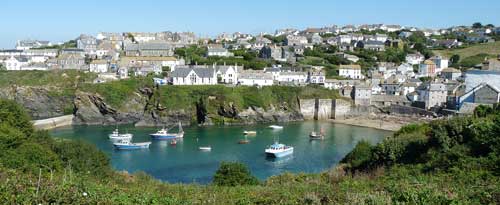
Port
Isaac. Less than ten miles down the coast from Tintagel
has always sat (at least since the 15th century) the village of Port
Isaac, largely unnoticed and ignored by visitors until the TV
series
about village doctor Martin Ellingham (i.e., “Doc Marin”) woke
the town
up and put all 700 folks who lived there on the map of “must see”
places. Port Isaac was our primary destination of the trip. We devoted
most of a day to walking through this picture postcard fishing village
that is the setting for this British comedy series beginning its 6th
season. The day was gloriously sunny and warm, and the walk
through the village was very pleasant. There were quite a few people
visiting, especially for a Tuesday morning; the car park overlooking
the harbor and village was full by 10 a.m. (A car park on the edge of
town is a very sensible approach to dealing with visitors since the
roads in this and other small towns are barely passable for single
cars, and parking was, as far as we could see, virtually nonexistent.)
We easily found Doc Martin’s surgery (that’s the
small stone house in the middle of the photo), Louisa’s home and the
village
school, Mr Large’s restaurant (the house on the bottom left, also a
private house), Mrs Tishall’s pharmacy, other places
associated with the program. We had an early lunch on the porch of the
Golden Lion Pub
overlooking the harbor (Mr Large’s wonderfully located
restaurant is, in fact, a private home!)
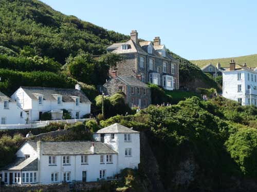
In the late afternoon
before we left, we treated ourselves to tea (and coffee) and scones
with clotted cream and jam. Veddy British, we thought, and the
patio of
the Hathaway B&B
that overlooks the village and harbor was a
sensational spot to celebrate this British tradition and feel a bit of
luxury. At the end of the day we walked the half mile uphill to the car
park before sunset for our drive back to Woodford Bridge. Driving is
hazardous enough during the day, but doing it in the dark would add to
the burden of both the driver and passenger.
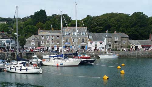
Padstow. This is another lively
and
attractive fishing village that has grown and prospered perhaps more
than others we visited. A monastery was built here at the mouth of the
River Camel in 500 C.E. in honor of the Welsh missionary St Petroc. The
church of St Petroc was erected between the 14th and 16th centuries.
(The name Padstow probably evolved from the name Petroc and stow,
meaning meeting place.) Fishing and the import of lumber from Canada
were the main industries until the arrival of tourists, especially
those with yachts which dominate the small harbor. Restaurateur Rick
Stein has invested heavily in Padstow, creating at least four popular
restaurants besides a deli, gift shop, patisserie, and other retail
outlets. His name dominates the business district to the point where
some locals refer to the town as “Padstein.” Across the Camel estuary
is the quiet village of Rock
separated by a hazardous (to sailors) sand
bar known as Doom Bar, which gives its name to a fine cask ale produced
by Sharp’s
Brewery (now a subsidiary of Molson Coors) in Rock.
Of course we ate at one of Mr Stein’s fish
restaurants. The line to get in moved quickly enough and the food was
worth waiting for. We enjoyed our walk through the village, and ended
up walking part of the Camel Trail, a
section of the South West
Coast
Path, away from town and up the hill for a scenic overlook of the
estuary and Atlantic Ocean. And we probably enjoyed an ice cream cone
from one of the many shops serving “real Cornish ice cream.”
Marazion
and St. Michael’s Mount.
At the south end of Cornwall are the towns of Penzance, St Ives, and
Marazion. Dominating the view from Marazion
is the tidal island of St.
Michael’s Mount a quarter of a mile off shore. A cobblestone
causeway
provides access at low tide; a short boat ride (£2.00 for adults)
takes visitors at high tides.
St Michael’s Mount is the Cornish
version
of Mont
Saint-Michel, a similar tidal island crowned by a monastery off
the coast of Normandy. There is evidence that St. Michael’s Mount
was
originally located in a dense forest some six miles from the ocean, but
a spring flood in 1099 overflowed the shore, destroying many towns and
drowning people and farm animals. The church was built by 12th century
Benedictine monks and was later converted into a fortress during the
War of the Roses (1400s)
and again during World War II. The island and most of the property was
turned over to the National Trust in 1954 by the St Aubyn family who
were the last owners of the property. Today the few people who live on
the island, mostly staff working on the island, are supplied by an
underground railroad that transports goods from the mainland to the
castle.
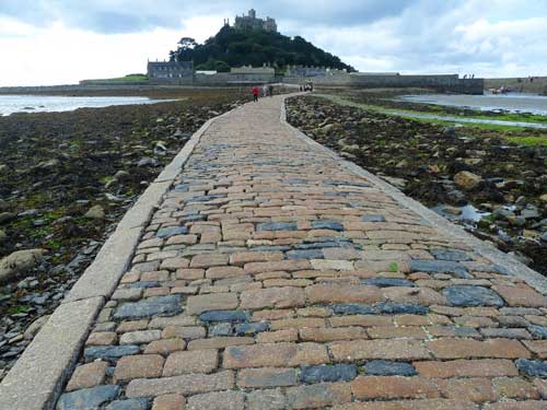
A word of warning to unsuspecting visitors who don’t
do their homework: the island properties are closed to the public on
Saturdays! (And apparently access during the winter months is
curtailed.) We were able to make the pleasant walk to the island,
around limited non-restricted areas, and use the public bathrooms. But
the castle, the gardens, the cafe and restaurant and shops were closed.
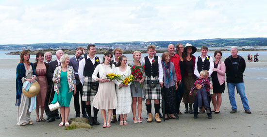
However, perhaps because it was a Saturday and fewer visitors would be
in the area, a couple from someplace in the Midlands were present along
the causeway to have family wedding pictures taken with St. Michael’s
Mount as a backdrop. The location was very striking and perfect for
group photos. Everyone looked better with a beachside backdrop!
Penzance. We were quite curious about
what we might find in Penzance,
a city of over 21,000, the largest town
we visited in our trip. Its romantic image associated with G&S’s
“Pirates
of Penzance” set the stage for the disappointment we felt as
we discovered traffic snarls, parking issues, and the throngs of people
that crowded the streets on a Saturday morning. The area has a long
history that dates from perhaps as early as the Bronze Age, though
recent discoveries suggest Roman occupation in the first century C.E.
In spite of its oceanside setting, Penzance survived as a principle
market town in the area. Later the railroad and steamships supported
the economy. This
emphasis on commerce seems to continue to present times.
Fortunately for us, the downtown area has many
secondhand/thrift/resale stores which we poked through, but we found
little sense of history, beauty, or the charm of other harbor side
towns we had visited until now.
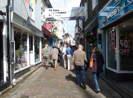
St. Ives.
We had booked accommodations
at a B&B in St Ives and saw little reason to extend our visit to
Penzance. We took the “extra” time we had to make our way slowly up the
coast on the B3306, a twisting, narrow scenic route through St. Just (a charming
village,
once a center for tin mining surrounded by moorlands, where we spent
longer visiting than we had anticipated; the 15th century church alone
was worth the extra time, and there is much more to see and explore
than we had time for); Pendeen
and Morva are
small towns along the way that contain visual relics and buildings that
remind visitors of an active mining industry (Tin was to southern
Cornwall what coal was to Wales. In fact, many of the miners who
worked
in the gold mines in the western USA were immigrants from Cornwall who
brought their experience and skills—and their language and culture—to
towns all over the west,
including our home town of Nederland and nearby Caribou, Colorado).
Time was drawing near when we felt we needed to
arrive in St.
Ives and check in with our B&B host, Steven
Williamson whose home overlooks the town of 12,000. He rents out
just one splendid room (second floor on the left with the big window)
with a spectacular view of town and one of its
four beaches. It’s good we got there ahead of schedule because we had
some difficulty finding his place. Once we found him, he welcomed us
with coffee and biscuits, information about the town, suggestions for
what to see and where to eat, and a tidy room with a private bath.
St. Ives was once a thriving
fishing village but its
mild climate, scenic seaside location, and many visitor attractions
(e.g., Barbara
Hepworth Museum and Sculpture Garden, Tate St. Ives,
galleries, diverse shopping, several distinct beaches, et al.) have
earned the city the British Travel Award as “The Best UK Seaside Town”
in 2010 and 2011, and “The Best Seaside Town of 2007” by the Guardian
newspaper. The awards seem to us to be well deserved. Despite its size,
the town is pedestrian friendly, big enough for diverse shops,
restaurants, and other retail opportunities, yet it retains the
leisurely pace and accessibility of a small town.
We really enjoyed our first evening in town. We were
tempted to have dinner at the recommended Seafood Cafe, but it lacked
the warmth of a pub atmosphere which we had come to appreciate. We
backtracked a few blocks and settled in at the Union Inn, also on Fore
Street, for a dinner of fresh seafood, cider, and a pint of Doom Bar
Bitter. Afterwards, we strolled through the downtown, stopped in a
well stocked bookstore, passed the Hard Prawn Restaurant wondering what
we might have missed, and walked along the harbor to where a crowd had
gathered to listen to a group of men singing shanties and folk songs
(Impromptu? maybe. Rehearsed? absolutely. Popular? no question. They
had a large and growing audience who, with glasses in hand, sang along
with them. Paid? No sign of money exchanging hands. Just a lot of
smiling at one another for the pleasure of a performance well done.)
It was our only night in St. Ives (which left us
wanting more and a desire to return if we ever come back to England).
The next morning we enjoyed Steven’s full English breakfast that filled
us for the rest of the day. We packed and locked our bags in the car
and walked the town for the next few hours to explore what we had
missed the afternoon and evening before. We walked past the Barbara
Hepworth Museum and the Tate, not visiting either since our time was so
limited; we found a small piece of quiet surrounded by the city in a
well kept not easy to find garden with tropical plants in the town
center; we climbed to the top of “the
island” (really a peninsula) for views of the whole town and
several beaches. By this time it was time to make our getaway and head
for Heathrow.
OUR RETURN TO LONDON
The map says it’s about 300 miles from St Ives to
Heathrow and takes typically around five hours. That is, if (1) you
know the roads well and (2) there are no traffic snarls. It took us
closer to six hours, but instead of stopping for the night along the
way, we decided we would make the big push and go the full route that
Sunday afternoon. We missed only a couple of turns and had only a few
major
traffic slowdowns. We dropped the car off at the agency located
at the Holiday Inn on Sipson Road near Heathrow. Not only were their
accommodations clean, spacious, and not overpriced, but right next door
was The
Plough, a fine pub where we enjoyed an excellent meal (Judy fresh
fish, Hughes steak and ale pie), cider and real ale, and the company of
a couple from Derbyshire who had given us one of their chairs at the
bar; we later got a table for four and they joined us with stories of
life in the midlands. It was a splendid conclusion to an enjoyable
visit to England.
SOME
MISCELLANEOUS MEMORIES
• Driving in England is more than getting used to
being on the “wrong” side of the road, though that does take some
getting used to. The process is complicated by (a) narrow roads, many
without center line markings or lines on the side of the road. There
are no bike lanes and no room for pedestrians. It is
impossible to drive safely in small villages, if cars are allowed at
all; (b) lack of parking spaces forces folks to park in a lane of
traffic or half on a sidewalk and half in the road. It’s crazy; (c) too
few directional signs; (d) too many traffic
circles/rotaries/roundabouts and too few stop lights. Getting caught in
a two- or three-lane roundabout with too few direction signs is
dangerous to the driver, passenger, and other cars on the road; and (e)
British drivers drive far too fast. 80 mpg on the limited access
highways will often get you a horn and naughty gesture from other
drivers. Going too fast on the smaller roads is quite common. (f) Of
course, newcomers should have a good map at all times and review it
carefully before starting out each day.
• Admittedly there are too many fish and chips
places, and ice cream is everywhere. However, we were surprised by how
good the food is in England, especially in pubs. The food is as good as
the company. A pub half filled with small groups of people who keep to
themselves or eat by themselves is a sign, to us, that the food is
probably sub par, and is not a place where you want to eat. Seek out
those places that are almost filled by 5:30-6:00, get a table near the
bar—or eat at the bar—and make friends with those near you. It will be
the best meal you can have. We tried as many foods that were new to us
as we could find: clotted cream, pasties, black pudding, real ale,
steak and ale pie, high octane cider. We missed Scotch
eggs, which
we’ll look for the next time we visit. We bought a round (900g) of “Farmhouse Mature Cheddar" (from
the Maryland Farm, Ditcheat, Shepton Mallet, Somerset) which puts
every cheddar from the USA to shame for flavor and texture. Wonderful
stuff. We should have brought back three rounds. However, it's for sale
on line at the website above.
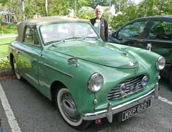
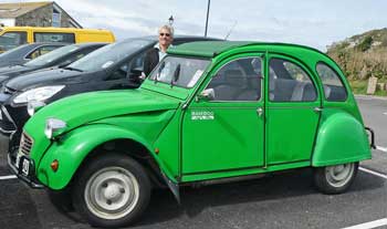
• We saw quite a few cars, both new and old, that we
never see in the states: several hump-back Citroens big enough for
maybe two people but with that distinctive design that calls attention
to them; new Skodas that zipped along the M4 and M5 at +80 miles an
hour; several Morgan sports cars in great shape; a 1952 Austin that was
in mint condition; and a pre-WWII open top roadster of some make that
would be the envy of any car collector. It goes without saying that
with the exception of an occasional Range Rover, 99% of all the cars
were tiny, appropriate for the narrow roads we traveled. Our rented
Yaris was one of the biggest cars on the road.
• Try real ale in
favor of “cask” ale. Always on
draft. Try cider/cyder in place of wine. Also on draft.
• We saw different signs at farm houses along the
back roads in both
Devon and Cornwall advertising “Fresh Eggs,” “Cornwall Eggs,” “Real
Eggs,” and “Proper Eggs” as well as eggs. We should have stopped just
to find out the differences, but we never did.
• There is very little litter along any of the
roads. And there are no signs indicating a group or individual was
responsible for cleaning a section of road. The British are, by and
large, a tidy people.
• Brits apparently love to hike. Signs indicating
public footpaths are everywhere. They often appear suddenly without a
place to pull over and park to begin hiking. However, cities and
villages along the coast have connections to a variety of footpaths. It
is possible to walk the entire coastline. We wish there were as many
opportunities for bicycling. We never encountered any roads that have
shoulders for pedestrians or bicycles; bike paths, like the Tarka Trail
or Camel
Trail out of Padstow, are few and far between. Too bad; both of
those are rails-to-trails projects and there must be miles and miles of
train lines that are out of use today just waiting to be converted.
Perhaps Bradley Wiggins’ celebrity status will boost interest in
bicycling.
• Much of the countryside, especially in rural
southwest England, remains a mystery to us. We’re sure the vistas are
gloriously green and bucolic, dotted with sheep and cows munching a
rich grass. (We did see some.) However, the hedgerows are usually so
tall and constant along the rural roads that we had few opportunities
to enjoy the rural landscape. Pullouts came upon us without warning so
that we couldn’t pull over and make our way past the stone walls
covered with bushes to see the views from the other side. We did,
however, manage to get a few images of the green countryside, farms,
and hedgerows.